Profile
Nillumbik is renowned as the Green Wedge Shire, located 25 kms north-east of Melbourne. Key centres include Eltham and Diamond Creek, as well as rural townships including Hurstbridge and St Andrews.The Green Wedge covers 91 percent of the total area of the shire and is characterized by steep ridges and gentle sloping hills, enclosing plains and flats. Kinglake National Park, reserves and bushland, together with lifestyle properties, hobby farms, orchards, wineries and broad acre farms all make up this unique landscape.
The people of the shire enjoy a healthy, safe, family-friendly lifestyle within close knit communities. Our townships offer residents and visitors distinctive village-style shopping, access to professional services and public transport and places to meet and socialise. Striking mud-brick buildings and award winning wineries complement the shire’s unique and diverse landscape. Nillumbik is also an arts-rich environment. The creative life of the community is highly-valued and large numbers of artists live and work here in the quiet beauty of our landscape. The shire also has a strong performing arts community.
Council information
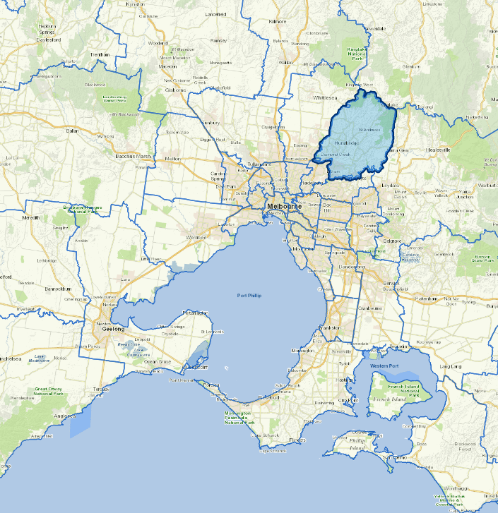
Vicmap Basemap Services @ 2023 State Government Victoria | Copyright and Disclaimer
For a detailed map showing shire boundaries and locality names, visit VICNAMES
Localities
Arthurs Creek, Bend of Islands, Briar Hill, Christmas Hills, Cottles Bridge, Diamond Creek, Doreen, Eltham, Eltham North, Greensborough, Hurstbridge, Kangaroo Ground, Kinglake, Kinglake Central, Kinglake West, Nutfield, Panton Hill, Plenty, Research, Smiths Gully, St Andrews, Strathewen, Warrandyte North, Watsons Creek, Wattle Glen, Yan Yean and Yarrambat.
Updated