Profile
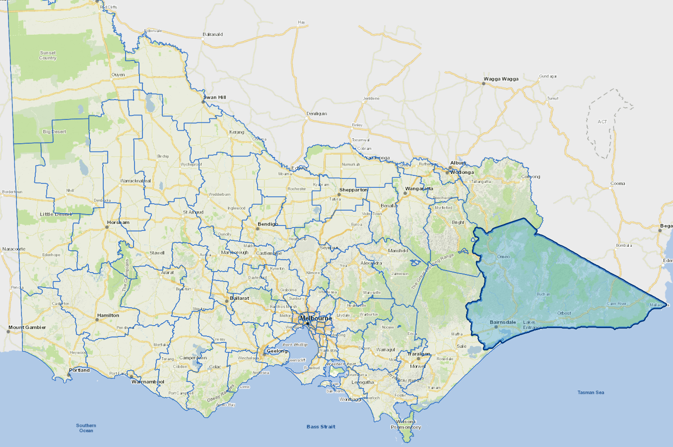
East Gippsland Shire, in south-east Victoria, covers the second largest area in Victoria.
The Shire includes an extensive coastline, a major lakes and river system, rugged high country, extensive national parks and state forests. About 75% of the Shire is public land held as National and State reserves. The commercial centre is Bairnsdale, a three-hour drive from Melbourne.
The shire's economy is based on tourism, agriculture, horticulture, forestry and fishing.
The main industries include oil and gas extraction, agriculture.
Population is centred around the Gippsland Lakes area. Together with the Buchan Caves, these are a great attraction to visitors and retirees.
Council information
Vicmap Basemap Services @ 2023 State Government Victoria | Copyright and Disclaimer
For a detailed map showing shire boundaries and locality names, visit VICNAMES.
Localities
Anglers Rest, Bairnsdale, Bairnsdale East, Bellbird Creek, Bemm River, Benambra, Bendoc, Bengworden, Bete Bolong, Bete Bolong North, Bindi, Bingo Munji, Bonang, Boole Poole, Broadlands, Brodribb River, Brookville, Bruthen, Buchan, Buchan South, Buldah, Bullumwaal, Bumberrah, Bundara, Butchers Ridge, Cabanandra, Cabbage Tree Creek, Calulu, Cann River, Cape Conran, Cassilis, Chandlers Creek, Clifton Creek, Club Terrace, Cobbannah, Cobberas, Cobungra, Combienbar, Corringle, Dartmouth, Deddick Valley, Delegate River East, Dellicknora, Deptford, Doctors Flat, Double Bridges, Eagle Point, Ellaswood, Ensay, Ensay North, Erinunderra, Fairy Dell, Fernbank, Flaggy Creek, Forge Creek, Gelantipy, Genoa, Gipsy Point, Glen Valley, Glen Wills, Glenaladale, Goon Nure, Goongerah, Granite Rock, Haydens Bog, Hillside, Hinnomunjie, Hollands Landing, Iguana Creek, Jarrahmond, Johnsonville, Kalimna, Kalimna West, Lake Bunga, Lake Tyers, Lake Tyers Beach, Lakes Entrance, Lindenow, Lindenow South, Lochend, Lucknow, Mallacoota, Manorina, Maramingo Creek, Marlo, Marthavale, Melwood, Merrijig, Metung, Mitta Mitta, Mossiface, Mount Taylor, Murrindal, Nariel Valley, Newlands Arm, Newmerella, Nicholson, Noorinbee, Noorinbee North, Nowa Nowa, Nungurner, Nunniong, Nurran, Nyerimilang, Ocean Grange, Omeo, Omeo Valley, Orbost, Paynesville, Raymond Island, Reedy Creek, Sarsfield, Shannonvale, Simpsons Creek, Stirling, Suggan Buggan, Swan Reach, Swifts Creek, Tabberabbera, Tambo Crossing, Tambo Upper, Tamboon, The Fingerboards, Timbarra, Tom Groggin, Tonghi Creek, Tongio, Toorloo Arm, Tostaree, Tubbut, Uplands, W Tree, Wairewa, Wallagaraugh, Walpa, Wangarabell, Waterholes, Waygara, Weeragua, Wingan River, Wiseleigh, Wombat Creek, Woodglen, Wroxham, Wuk Wuk, Wulgulmerang, Wulgulmerang East, Wulgulmerang West, Wy Yung and Yalmy.
Updated