We’re planning for the future of transport in Fishermans Bend, to support transport infrastructure needs in line with population growth.
The Fishermans Bend Integrated Transport Plan identifies a suite of integrated transport initiatives over three broad delivery horizons to support the realisation of the vision and sustainability goals for Fishermans Bend.
- Horizon one focuses on:
- providing safe access to schools for people walking and cycling
- increasing bus services including a connection to Anzac Station
- rerouting the 86-tram route to Port Melbourne and the 109 route to Waterfront City in Docklands to provide for increased capacity
- improving active transport routes including connections across the West Grate Freeway
- optimising the freight network via preferred corridors.
- Horizon two focuses on:
- delivering new tram routes connecting Fishermans Bend to the CBD via Southbank
- extending active transport routes including access across the Yarra River
- investigating a rebuild of the Salmon Street bridge
- providing more direct links for port freight traffic to the freeway network
- supporting the investigation of a new freight link to Webb Dock.
- Horizon three focuses on:
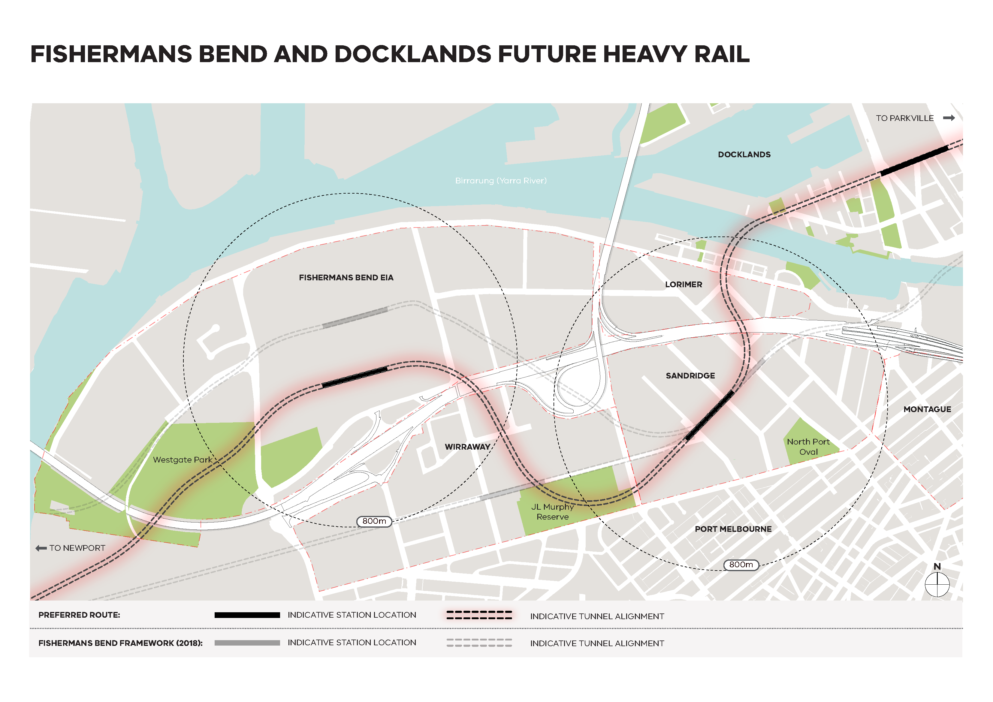
- delivering a heavy rail tunnel through Fishermans Bend and Docklands with stations at Docklands (near Southern Cross Station) and Fishermans Bend (Sandridge Precinct and the Innovation Precinct)
- delivering new active transport connections across the West Gate Freeway to ensure access from the Lorimer Precinct to Sandridge Precinct Station and from the Wirraway Precinct to the Innovation Precinct Station.
The refined route for the potential future train tunnel will be protected in local Planning Schemes ensuring new buildings and infrastructure do not compromise the future rail infrastructure, while maximising the extent of development that can occur around and near the corridor.
See the frequently asked questions for the rail route on our FAQ page(opens in a new window).
See the updated maps from the Fishermans Bend Framework(opens in a new window) reflecting the refreshed Integrated Transport Plan.
Updated