The DSA is an ‘out of the box’ tool, available in the ArcGIS Business Analyst extension, commercially known as Suitability Analyst. The tool transforms and combines geographical data and evaluation criteria to solve spatial problems. The evaluation criteria are determined by expert opinion and knowledge of the datasets.
The initial DSA accommodates multiple spatial inputs and supports the development of a single risk map.
The outputs outlined in Sections 2.4 and 2.5, produced at the SA1 scale, are input to the tool. The initial DSA workflow is computed in four steps:
- Make the initial DSA base layer (SA1 boundaries).
- Add field-based criteria (Sections 2.4 and 2.5).
- Set criteria properties (see Appendix B).
- Calculate initial DSA fire risk score (see Appendix B, Equation 1, Equation 2).
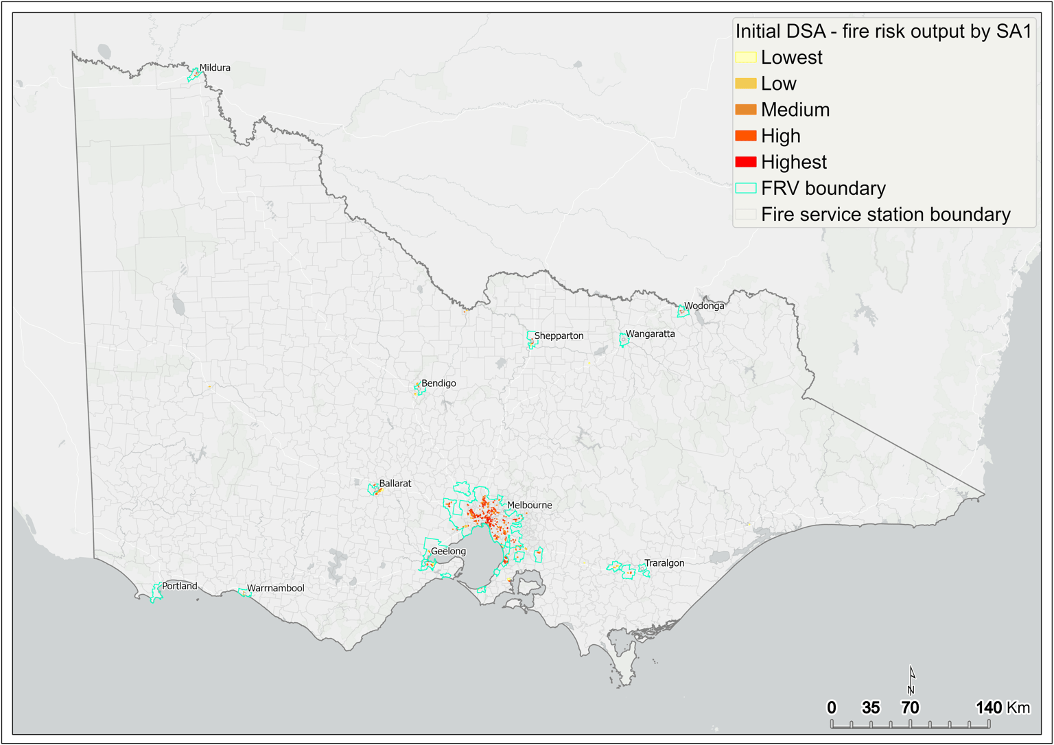
The initial DSA score represents the fire risk score, which is subsequently mapped across the SA1 areas of Victoria (Figure 18).
3.1 Thresholds and influence
The levels of fire risk are defined according to the minimum and maximum thresholds and influence of each criterion (Table A1). This guides the identification in the initial DSA of SA1s that are consistently represented by high values. Thresholds are determined by interpreting statistical data for each criterion. For further information on this process, see Appendix B.
3.2 Statewide fire risk
The output from the application of the initial DSA ranks the SA1s according to a risk score, displayed as colour coded symbols in map format (Figure 18).
Risk scores are classified according to an equal interval,6 where the fire risk is subsequently mapped in five categories: Lowest, Low, Medium, High, Highest.
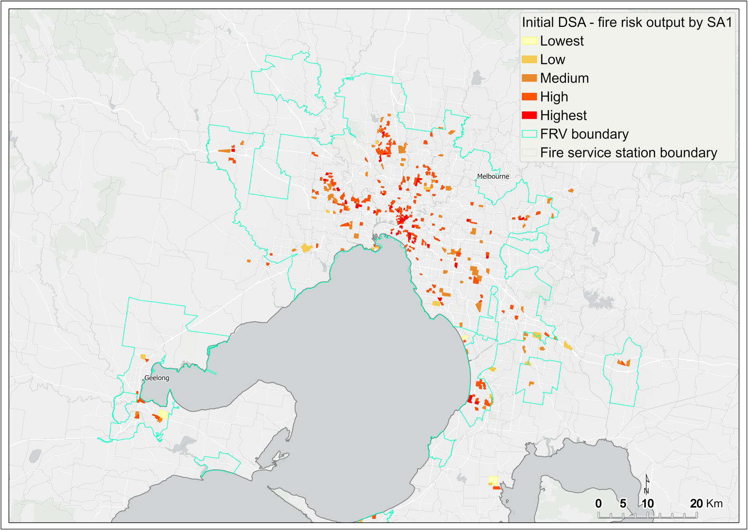
The spatial distribution of fire risk is shown across the state in Figure 18 and in the Melbourne metropolitan area in Figure 19.
The figures show that the most common fire risk category is High, and mapped SA1s occur in greatest numbers in the CBD and many inner and outer suburbs of Melbourne. This dominant risk category is also present in the larger regional centres, such as Ballarat, Bendigo, Geelong, Mildura, Wodonga, and Shepparton.
Figure 18 Initial DSA fire risk output by SA1 – statewide
Figure 19 Initial DSA fire risk output by SA1 – metropolitan Melbourne
Updated